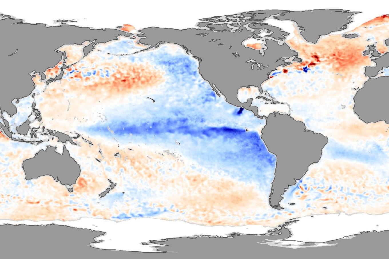
A powerful El Niño event now developing in the Pacific Ocean is on pace to become the strongest ever measured, according to analysis highlighted by Carbon Brief and several climate scientists tracking the phenomenon this year.
El Niño is the warm phase of a natural cycle called the El Niño-Southern Oscillation, or ENSO. During an El Niño, trade winds across the Pacific weaken or reverse, allowing warm surface water that normally pools near Asia to spread eastward toward South America. This suppresses the upwelling of cold, nutrient-rich water and temporarily raises global average temperatures. Its opposite phase, La Niña, has a cooling effect. Both phases typically last nine to 12 months, though they can persist longer.
Fastest warming on record
The current event began around June 2026 and is expected to last into 2027, according to Carbon Brief’s interactive explainer. Sea surface temperatures in the Niño 3.4 region, a stretch of the equatorial Pacific used as the benchmark for measuring El Niño strength, have been rising faster than at the same point in any of the previous 45 years of satellite records, outpacing even the major El Niño years of 1997 and 2015.
Zeke Hausfather, a research scientist at Berkeley Earth, examined 667 forecast ensemble members across 14 seasonal models in July 2026. His analysis found the event was very likely to be the strongest since reliable records began, and could exceed the previous record by a wide margin.
“No El Niño has run this hot by July.” — Zeke Hausfather, climate scientist, Berkeley Earth
Forecasts cited by Global Commons Alliance suggest the event could peak at roughly 3.6°C above the historical average in the Niño 3.4 region, compared with 2.75°C during the 2015-16 event, which was itself dubbed a ‘super El Niño’ by media at the time. Hausfather has noted that the gap separating the strongest El Niño events from more moderate ones in the past 150 years is typically around 0.5°C, underscoring how far this year’s projection stands out.
“Very likely to be the strongest event since reliable records began, it may end up the strongest by a truly mind-blowing margin.” — Zeke Hausfather, research scientist, Berkeley Earth
Why it matters beyond the Pacific
Carbon Brief cautions that ‘super El Niño’ is a media label rather than a recognised scientific classification. Still, the underlying data has led forecasters to sharply raise the odds of a new global temperature record. According to Hausfather’s analysis, cited by CounterPunch, the probability of 2026 overtaking 2024 as the hottest year on record rose from 13% in early July to 28% by mid-July.
Previous global heat records, set in 2010, 2015, 2016, 2023 and 2024, have generally coincided with El Niño conditions layered on top of long-term warming driven by greenhouse gas emissions. Carbon Brief stresses that while El Niño can push temperatures to short-term peaks, human-caused climate change remains the primary driver of the underlying trend.
El Niño also reshapes weather patterns far from the Pacific. The 2015-16 event was linked to a record-breaking central North Pacific hurricane season, severe drought in Ethiopia, and water shortages in Puerto Rico. El Niño years typically see more tropical cyclone activity in the Pacific but less in the Atlantic, as shifting wind patterns alter storm formation in each basin. Scientists are now watching closely to see whether the 2026-27 event, expected to peak between November 2026 and January 2027, produces similarly disruptive effects.
This article is free to read. It always will be — no paywall, no account, no tracking.